Mapping Crimes Against Rohingya
This platform maps the experiences of one group of Rohingya villagers and accompanies Amnesty International’s in-depth reporting on widespread war crimes perpetrated by Myanmar's military against the Rohingya population.
Explore the platform here:
mapping-crimes-against-rohingya.amnesty.org
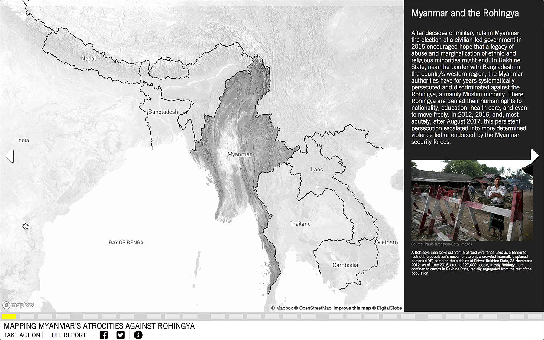
In late August 2017, after a series of coordinated attacks by the Arakan Rohingya Salvation Army (ARSA) on Myanmar security force posts in Rakhine State, security forces in Myanmar began a widespread campaign of violence against the entire Rohingya population in the region. The following ten months of military campaigns and attacks against civilians resulted in the expulsion of more than 702,000 Rohingya people into Bangladesh. Amnesty International’s investigation into the violence against the Rohingya community overturned evidence of widespread illegal detainment, torture, sexual violence, starvation and village burning. In all, Amnesty gathered evidence of nine of the eleven crimes against humanity listed in the Rome Statute of the International Criminal Court.
Weaving together a broad range of evidence—from maps, satellite images, photographs, drone footage and videos to testimonies and animations—the platform delivers a new level of visibility and clarity about these atrocities.
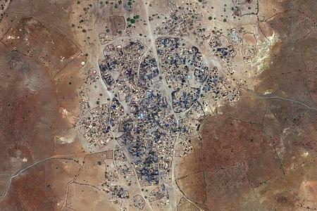
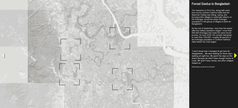
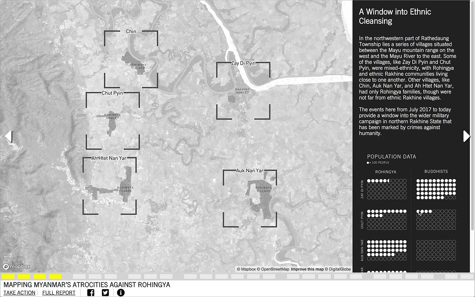
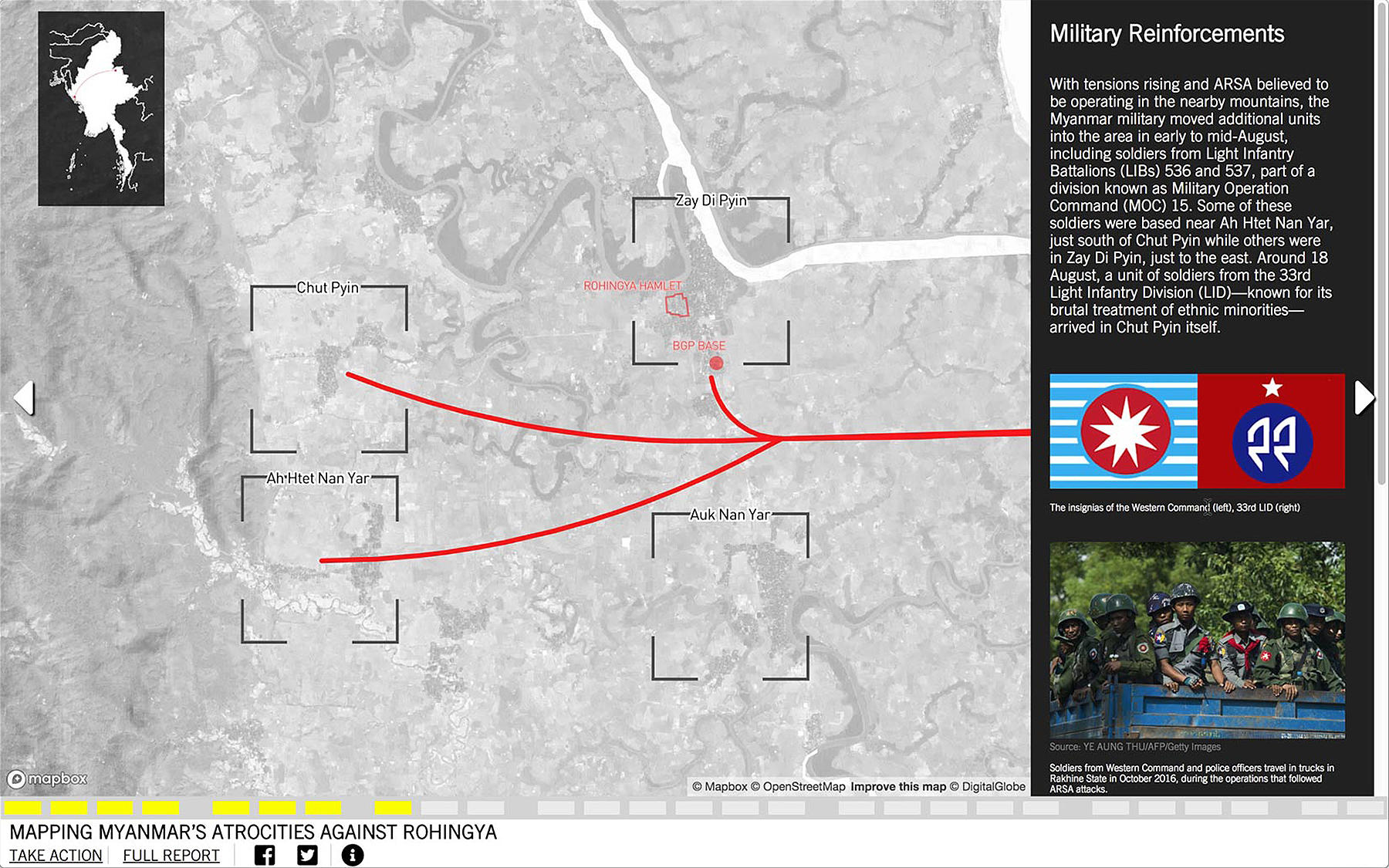
SITU produced an interactive mapping platform to accompany Amnesty’s long-form report that illustrates patterns of abuse of the Rohingya community by the Myanmar military in one well-documented village cluster in Rakhine State. The platform renders visible the highly orchestrated ethnic cleansing of the Rohingya population in Myanmar—providing an interactive timeline of events and recounting how Myanmar’s military systematically destroyed Rohingya villages with widespread burnings, massacres, rape, torture and starvation. The atrocities unfolding in one village cluster, in and around Chut Pyin in Rakhine State, are contextualized within the greater ethnic cleansing efforts undertaken in Rakhine State by Myanmar’s military.
In focusing on ground-truthing and visualizing the testimony, experiences and visual evidence of what occurred in Chut Pyin, SITU and Amnesty aimed to demonstrate a more broadly applicable pattern of violence. In Chut Pyin and in other Rohingya villages in Rakhine State with escalating tensions in August 2017, initial illegal arrests and torture of Rohingya community members were followed by the escalation of military presence, targeted attacks and village burnings, flight or passage to Bangladesh and finally the most recent reconstruction—remaking and resettlement of formerly Rohingya populated areas by Myanmar authorities.

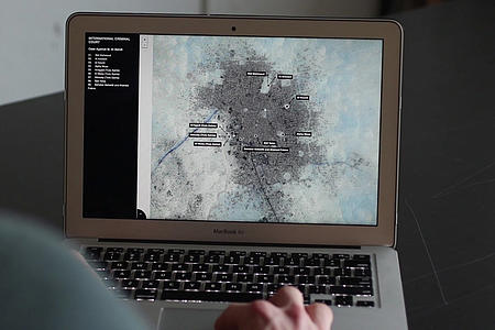
Tasked with creating a compelling spatial narrative that contains a series of explorable, interactive moments, SITU developed a platform in which users can engage directly with the exhaustive documentation that Amnesty has gathered on the case while moving through a sequential animated timeline. Weaving together a broad range of evidence—from maps, satellite images, photographs, drone footage and videos to testimonies and animations—the platform delivers a new level of visibility and clarity about these atrocities.
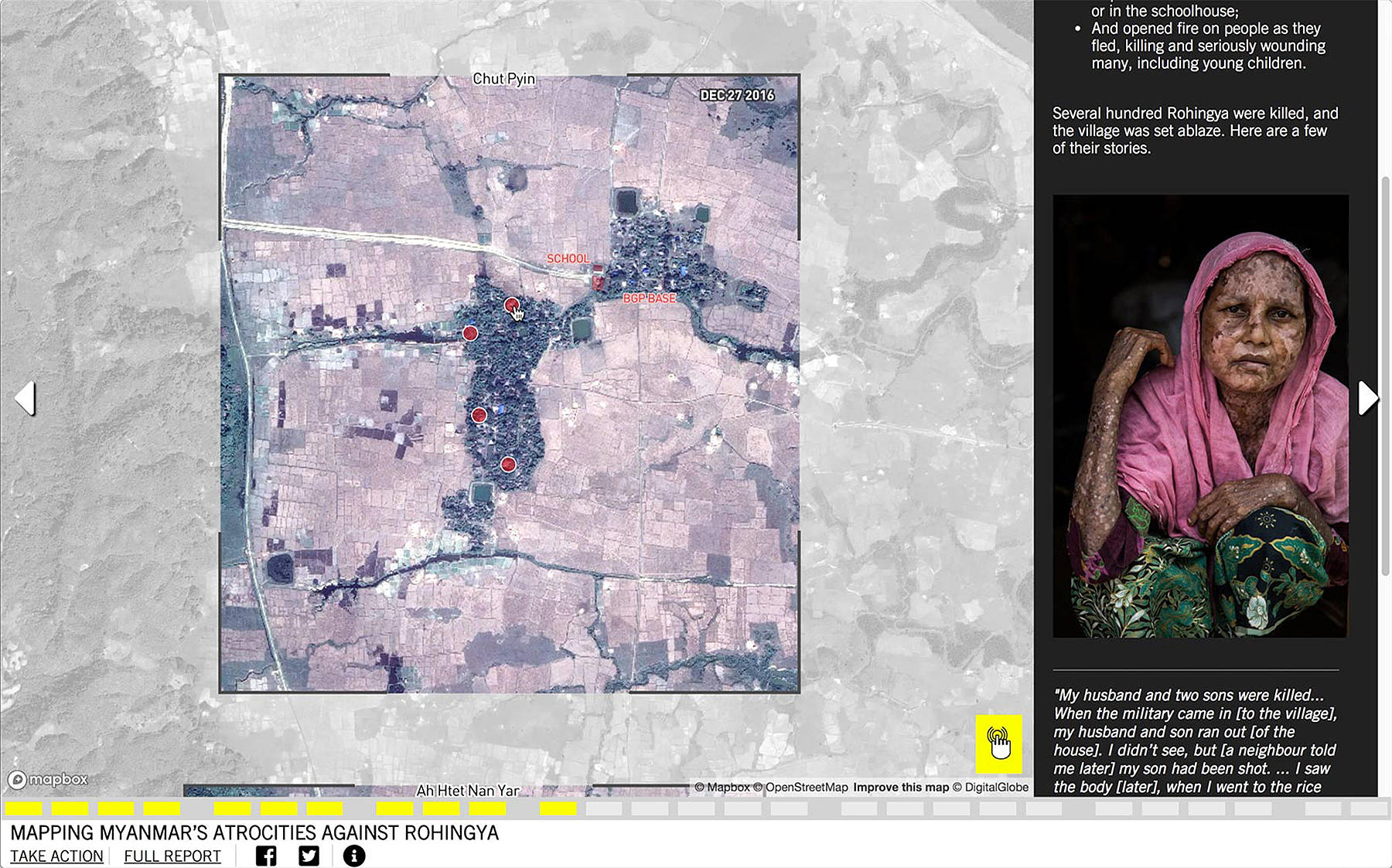

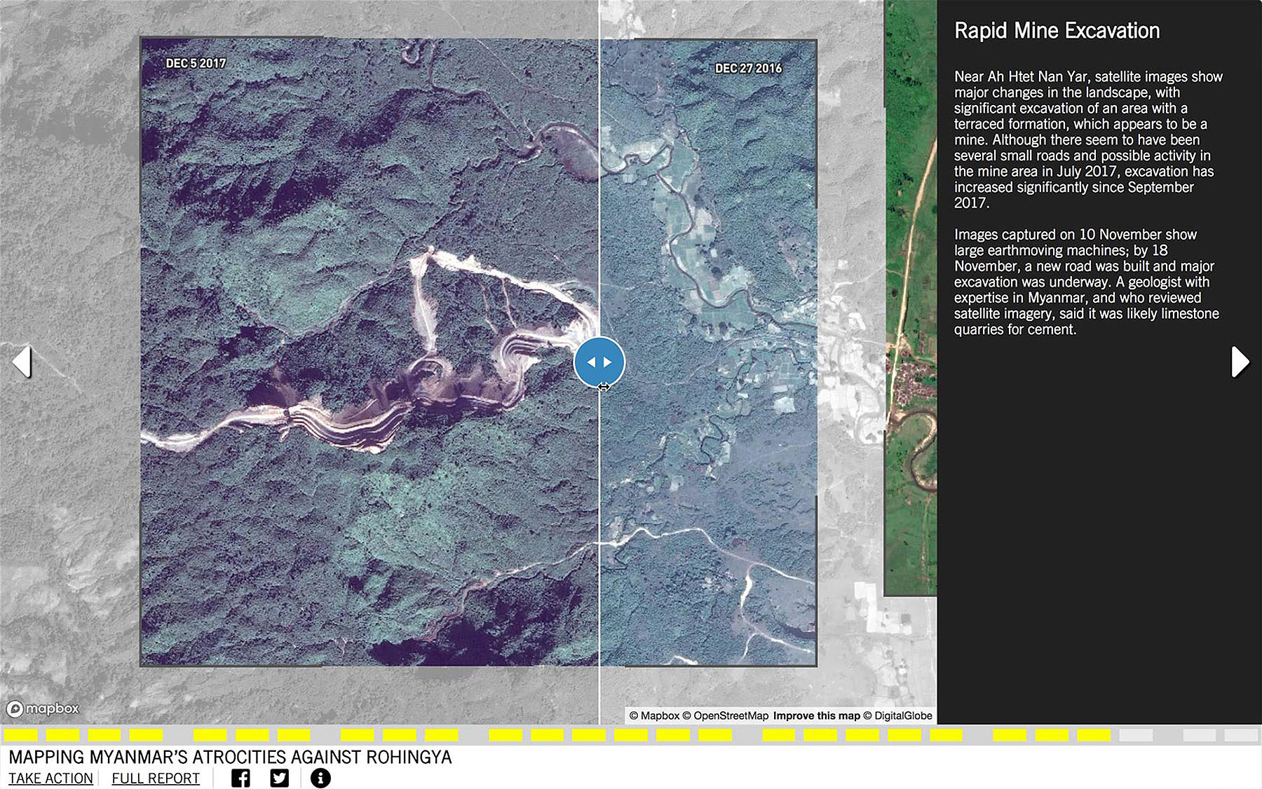
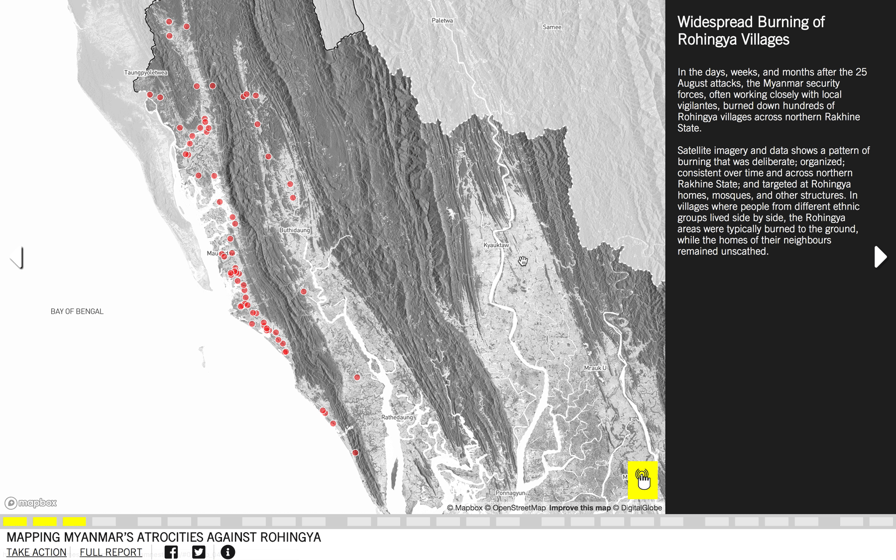
Satellite imagery plays an important role in this remote investigation and in SITU’s platform. Before and after imagery comparisons are woven into the spatial narrative at a number of key moments to illustrate the visible village burnings and infrastructural developments.
Abuses within the unfolding violence, displacement and subsequent resettlement and reconstruction in a village cluster were presented in the map developed by SITU that is featured prominently in Amnesty’s online campaign. The map works to strengthen Amnesty’s call for accountability from Myanmar’s military and will track the involvement of specific units in the violence against the Rohingya community.
This project is part of SITU’s Spatial Practice as Evidence and Advocacy (SPEA) project, which seeks to utilize spatial analysis and visualization in the service of human rights fact-finding and reporting. The work of SPEA is funded by the John D. and Catherine T. MacArthur Foundation, Oak Foundation and the Open Society Foundations. The project also received technical and web mapping support from Mapbox. For a more detailed account of the mapping methods and tools used on the project, read Mapbox’s blog post on our collaboration.
Related