Methods
Our approach to fact-finding and reporting is driven by a desire to remain unencumbered by technical constraints as we pursue clear, comprehensive and rigorous accounts of violations.
This requires an extensive range of skill sets, and the ability to work across data formats and types while often abiding to the strictest evidentiary standards. In each case, we might use any combination of the methods listed below as a means to better understand and communicate facts around contested events.
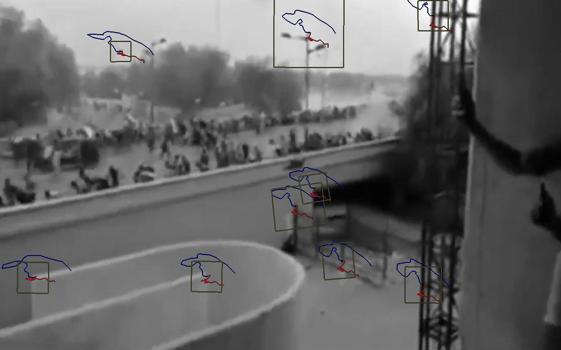
Video/Image Analysis
What it is
Extraction of pixel and metadata information from still and time-based frames.
What’s possible
Establishing the precise frame-relative location of people and objects, and —in videos—their precise timing, velocity and acceleration. When combined with 3D modeling, this data becomes geospatial, placing objects in real-world space instead of simply remaining in the photographic frame.
Common applications
Analyzing police conduct in heavily documented protests, quantifying volume and type of munitions use, reconstructing bullet trajectories.

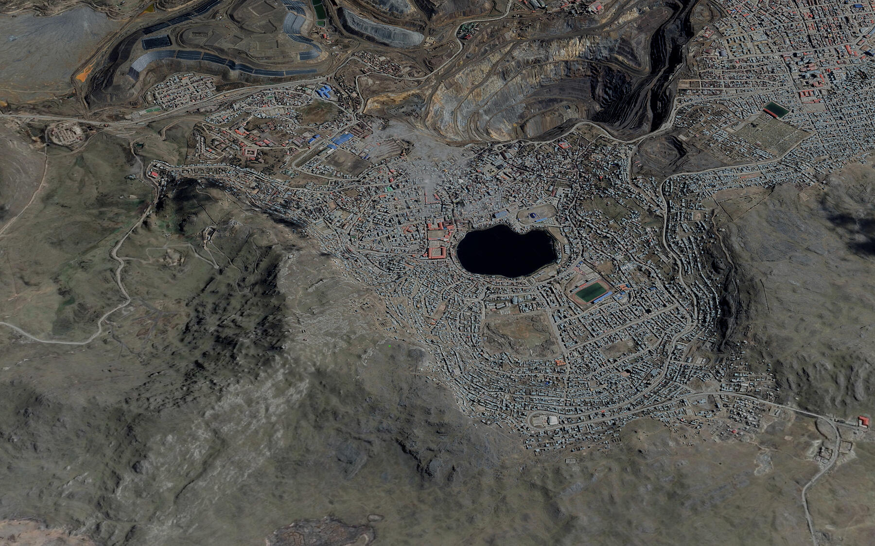
Remote Sensing
What it is
Data documenting the surface and atmosphere of the earth recorded by satellite or airplane, capturing geographic location over a period of time.
What’s possible
Establishing the location of structures across a larger surface and temporal resolution (similar to video and image analysis).
Common applications
Documenting the construction / destruction of large structures, reconstructing illicit transport such as human or arms trafficking, establishing climate trends
Geospatial analysis
What it is
Extracting new information from the manipulation of geolocated data, such as remote sensing imagery.
What’s possible
Computing statistics for large datasets of singular event data, calculating changes in a geographic area over time.
Common applications
Evaluating “before” and “after” documentation of a human rights violation, establishing patterns of violence over large geographic areas.

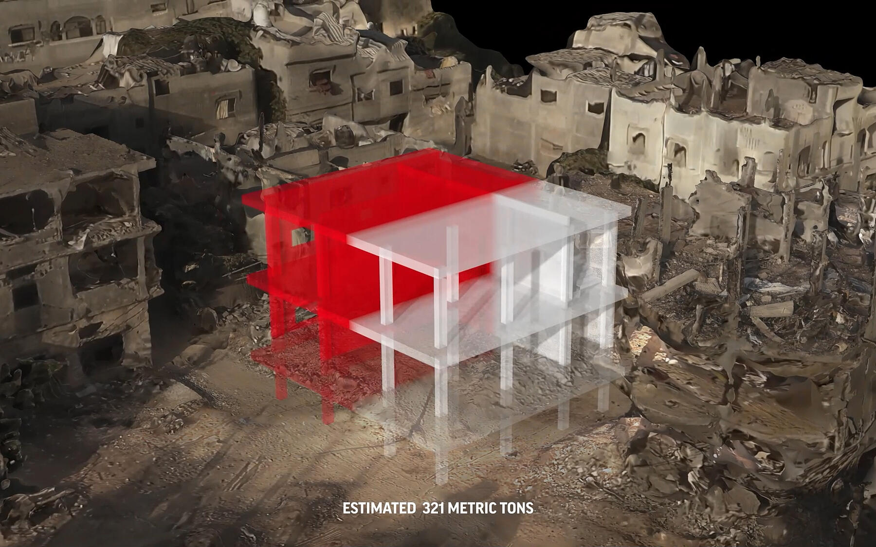
3D modeling
What it is
Building a digital model of a location or object of interest for the purposes of further analysis.
What’s possible
Using various sources, from open source government datasets to Google Earth and industrial plans, to create models of a building accurate to the inch, or of a tear gas canister accurate to the millimeter.
Common applications
Using various sources, from open source government datasets to Google Earth and industrial plans, to create models of a building accurate to the inch, or of a tear gas canister accurate to the millimeter.
Event reconstruction
What it is
Building a spatio-temporal digital model of an event by combining video analysis and 3D modeling.
What’s possible
Establishing the precise location and movement of people and objects of interest in three dimensions.
Common applications
Reconstructing violent events captured by user generated content where multiple narratives from governments or citizens diverge.

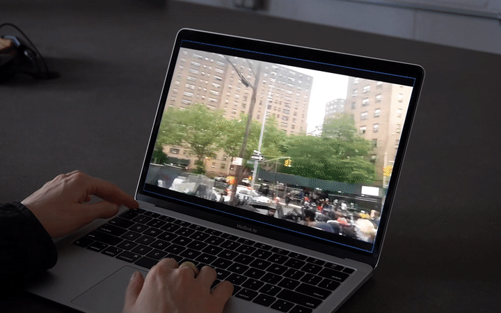
Platform development
What it is
Development of an interactive tool for the synthesis, visualization and query of media for use in court or for public dissemination.
What’s possible
Improving upon existing presentation methods such as PDF and slides, interactive platforms allow the user to look for and bring up evidentiary assets, such as videos or laser scans, in an intuitive fashion, optionally visualizing several assets simultaneously.
Common applications
Dissemination of diverse evidentiary formats in advocacy campaigns, evidence aggregation and visualization platforms for use in court.
Artificial intelligence/Machine Learning
What it is
Automation of digital tasks.
What’s possible
Exponentially faster and more accurate completion of tedious tasks, such as annotating each structure on a satellite image, or deducing the location of a camera based on its footage.
Common applications
Automating otherwise prohibitively time consuming tasks such as visual or audio feature recognition.