Forensic Oceanography Report

This Forensic Oceanography report is a spatial-temporal analysis of the events that led to the death of 63 migrants at sea off the coast of Libya in the spring of 2011.
Explore the report here:
https://forensic-architecture.org/investigation/the-left-to-die-boat
Collaborators
Lorenzo Pezzani, Charles Heller
Client
International Federation for Human Rights
Location
Tripoli, Libya
Completion
2012
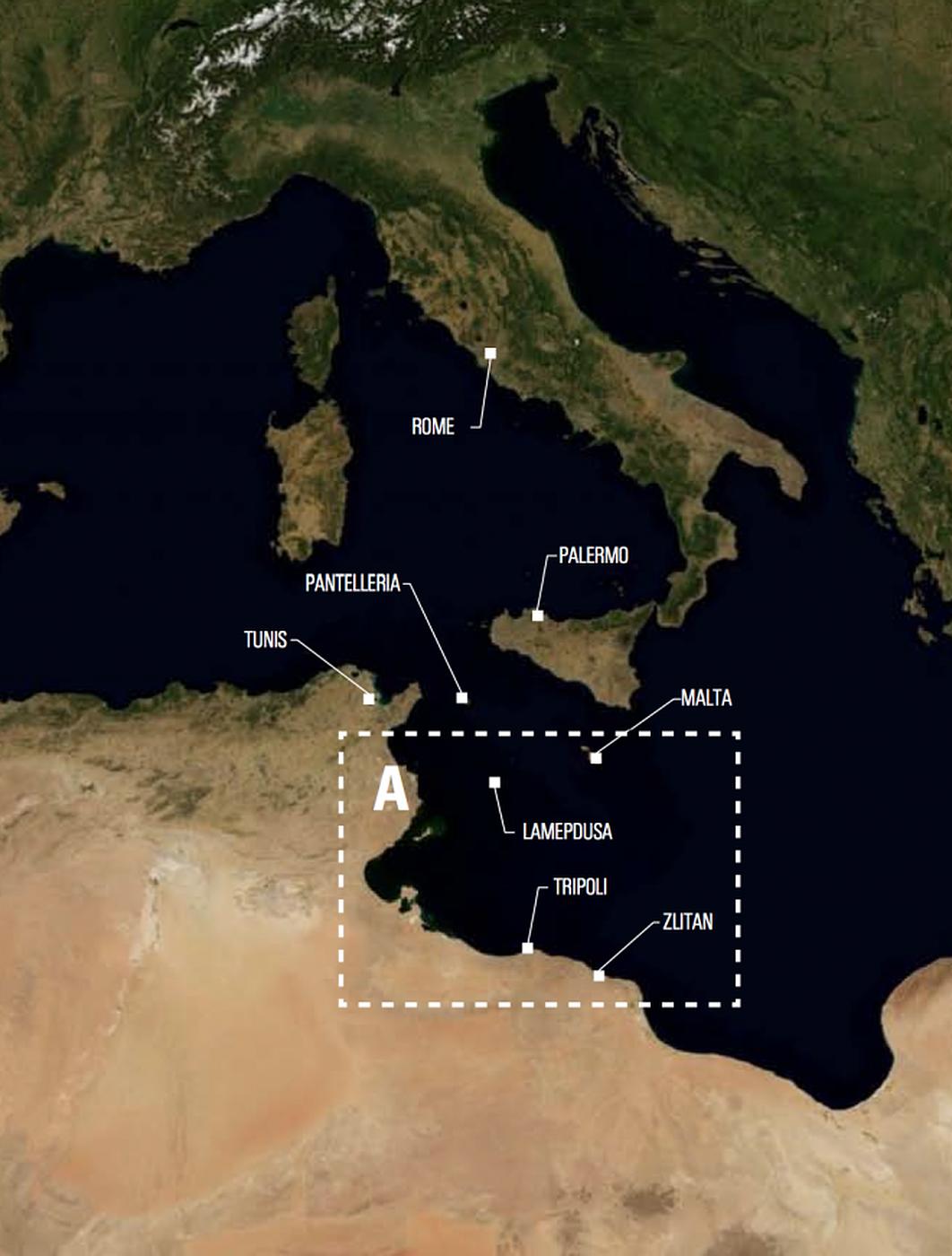
In the spring of 2011, during the NATO arms embargo on the Qaddafi regime, 72 migrants attempted to flee Libya departing from Tripoli and destined for Lampedusa, an Italian island in the Mediterranean Sea. They got halfway to their destination only to then run out of fuel and drift at sea for 14 days in what, at the time, was likely the most surveilled maritime zone in the world. In order to piece together the chain of events which ultimately resulted in 63 deaths, SITU collaborated with Charles Heller and Lorenzo Pezzani of Goldsmiths University's Centre for Research Architecture to produce a report on what has since become known as the “left to die boat.” The report was submitted as evidence in a lawsuit filed by the International Federation of Human Rights (FIDH) on the behalf of two survivors. The claim targets French and Spanish military ships for criminal neglect of the United Nations’ Law of the Sea protocol.
Article 98 of the United Nations Convention on the Law of the Sea
1. Every State shall require the master of a ship flying its flag, in so far as he can do so without serious danger to the ship, the crew or the passengers:
(a) to render assistance to any person found at sea in danger of being lost;
(b) to proceed with all possible speed to the rescue of persons in distress, if informed of their need of assistance, in so far as such action may be reasonably expected of him:
(c) after a collision, to render assistance to the other ship, its crew or passengers and, where applicable, to inform the other ship of the name of his own ship, its port of registry and the nearest port at which it will call.
2. Every coastal State shall promote the establishment, operation and maintenance of an adequate and effective search and rescue service regarding safety on and over the sea and, where circumstances so require, by way of mutual regional arrangements cooperate with neighbouring States for this purpose.
The report seeks to address what is ultimately a spatial question—who was present in the area, informed of the migrant vessel's distress and failed to respond?
During the course of the investigation, the team enlisted Richard Limeburner, Senior Research Specialist at the Woods Hole Oceanography Institute, to calculate a drift trajectory model of the boat, utilizing wind and ocean current data available through public databases such as MyOcean and EuroWeather.


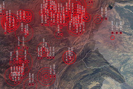
After consolidating a complex range of data, including remote sensing data, maritime Automatic Identification Systems (AIS), drift models, and survivor interviews, the report was able to offer a reconstruction of the chain of events throughout the migrant vessel's perilous journey, including its points of encounter with other maritime and aircraft assets.
By synthesizing several types of data, diagrams were created to elucidate the sequence of events beginning at the boat’s departure, through the point at which the boat begins to drift, and to the eventual landing south of Tripoli 14 days later.

To evaluate the probability that the migrant's boat came into contact with other vessels, the report employed synthetic aperture radar (SAR), which provided data sufficient to map positions of ships greater than 50 meters in length. The increased pixel intensity seen in Figure C, exemplifies a positive return for a large metal ship.
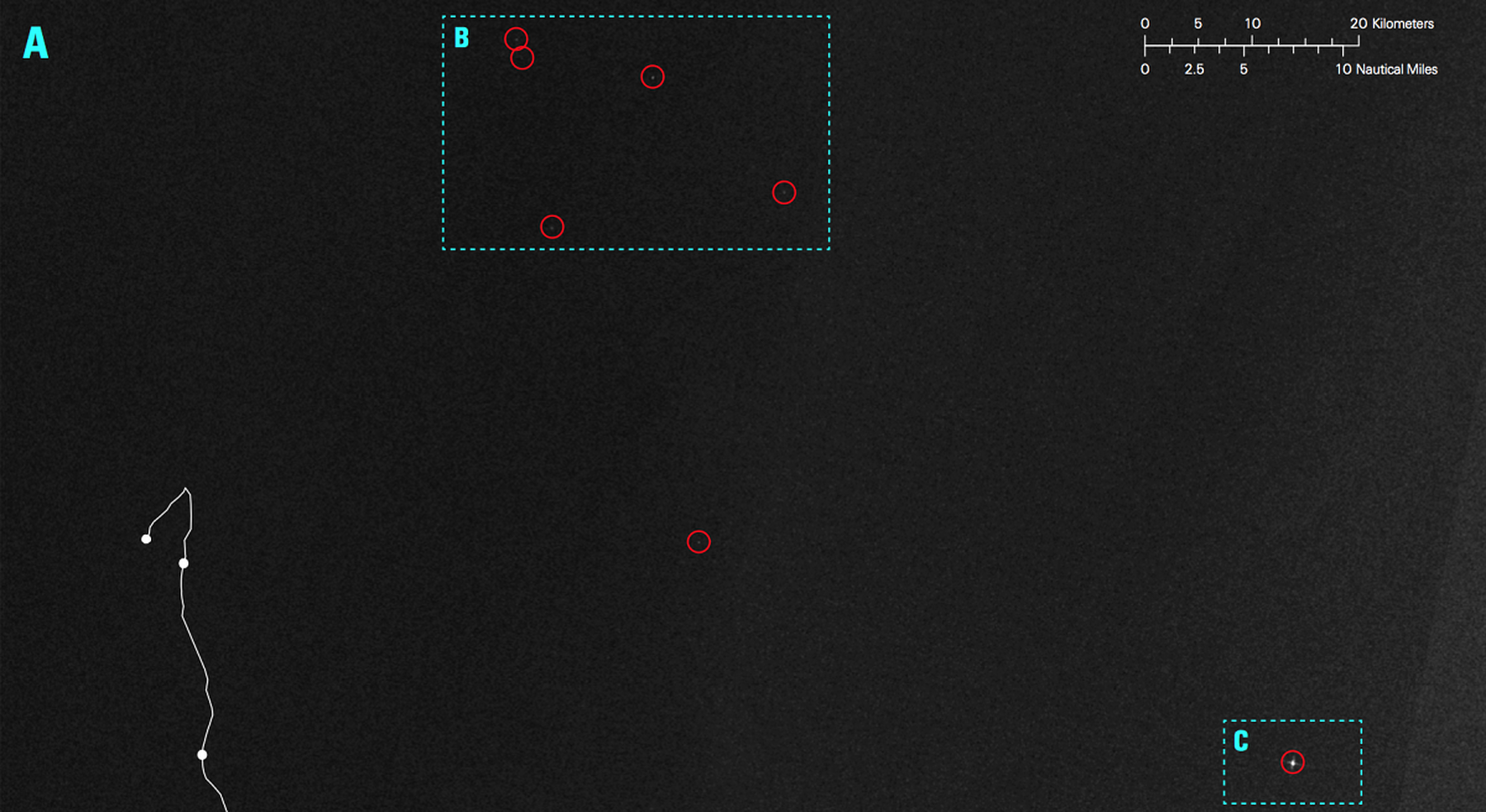
Using the SAR data, the team was able to juxtapose the reconstructed drift trajectory with the positions of nearby ships as they passed by. Because the drifting migrant’s vessel occurred within the embargo zone that was being patrolled by a wide range of NATO assets, the identification of these ships is of particular interest.
Survivor accounts have since helped to substantiate the correlations made between the calculated drift models and SAR data. Below is an interview conducted by SITU’s collaborators Lorenzo Pezzani and Charles Heller recording the testimony of one survivor, Dan Heil Gebre. By drawing upon both the empirical data (i.e. GPS coordinates and wind/current data) as well as the testimony provided by the survivors, the work done on this case was synthetic in nature. The report is an attempt to converge quantitative and qualitative data into a single context to create the most complete reconstruction of events possible. A full account is provided in the report itself and can be found here.
After the Paris Prosecutor’s Office ignored initial complaints in April of 2012, two of the survivors have since filed the case as civil parties, forcing open a judicial investigation as to why French and Spanish military ships criminally neglected a vessel in distress. For an updated and concise overview of the report and its legal proceedings, please click here to watch the live recording of FIDH's press conference June 18th, 2013. Skip to 31:00 min to see the work described in English.