Amnesty International Platform: Darfur, Sudan
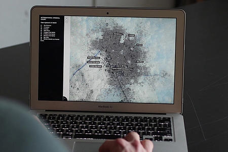
Produced for Amnesty International's Crisis Division, this is an interactive tool designed to aid in the reporting of government-led attacks on civilians in Jebel Marra, one of the most remote regions of Darfur, Sudan.
Explore the platform here:
http://darfurconflict2016.amnesty.org
SITU Research’s work with Amnesty International’s Crisis Division documents scorched earth and chemical weapon attacks against civilians in the Jebel Marra, Sudan. Launched in coordination with Amnesty’s address to the United Nations press corps, the platform was designed to present multiple forms of visual evidence to viewers, policy makers and advocates.
As one of the most remote regions in Sudan, the Jebel Marra is an incredibly difficult environment for humanitarian accountability. Our platform confronts this inaccessibility with documentation, interaction and visualization tools and set a precedent for the renewed advocacy efforts in Sudan.
Since January 2016, Sudanese government forces have been waging a large-scale military campaign in the Jebel Marra region, launching both ground and air offensives against villages thought to be home to members of the Sudan Liberation Army/Abdul Wahid. Documented attacks continued through September 2016, heavily impacting civilian populations in the region by killing and displacing thousands. Documented in Amnesty’s full length report on the ongoing crisis in Darfur, the attacks are considered war crimes under international law.
This project marks the first time that Amnesty has published findings from an entirely remote investigation. The investigation relied on 231 phone and internet interviews and satellite imagery for evidence of chemical warfare. Presented alongside photos taken in Jebel Marra, this evidence is being shared to call for further investigation and action to protect civilian populations on the ground.
SITU designed an interactive reporting platform that both maps the entirety of attacked villages in the imagery record and allows for a deeper investigation of attacks around which there are more robust visual, photographic and textual documentation.
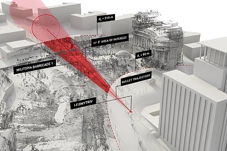
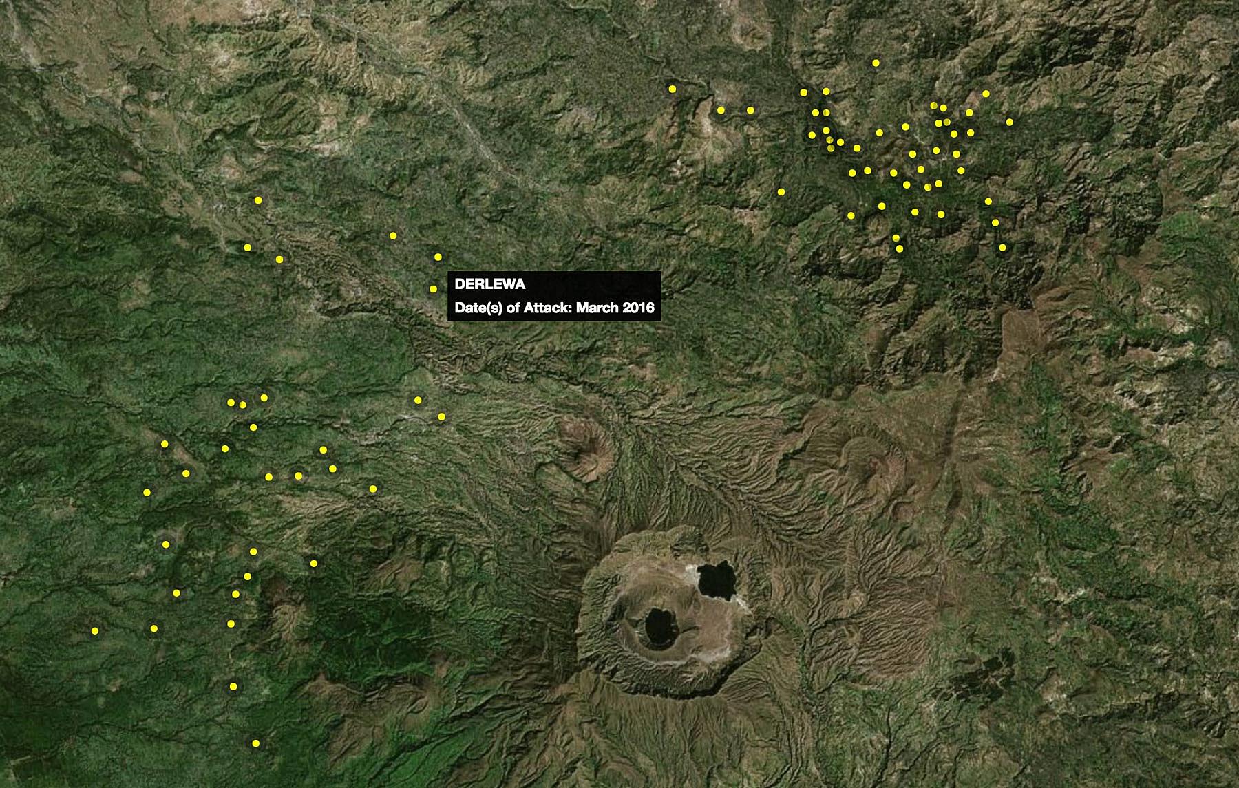
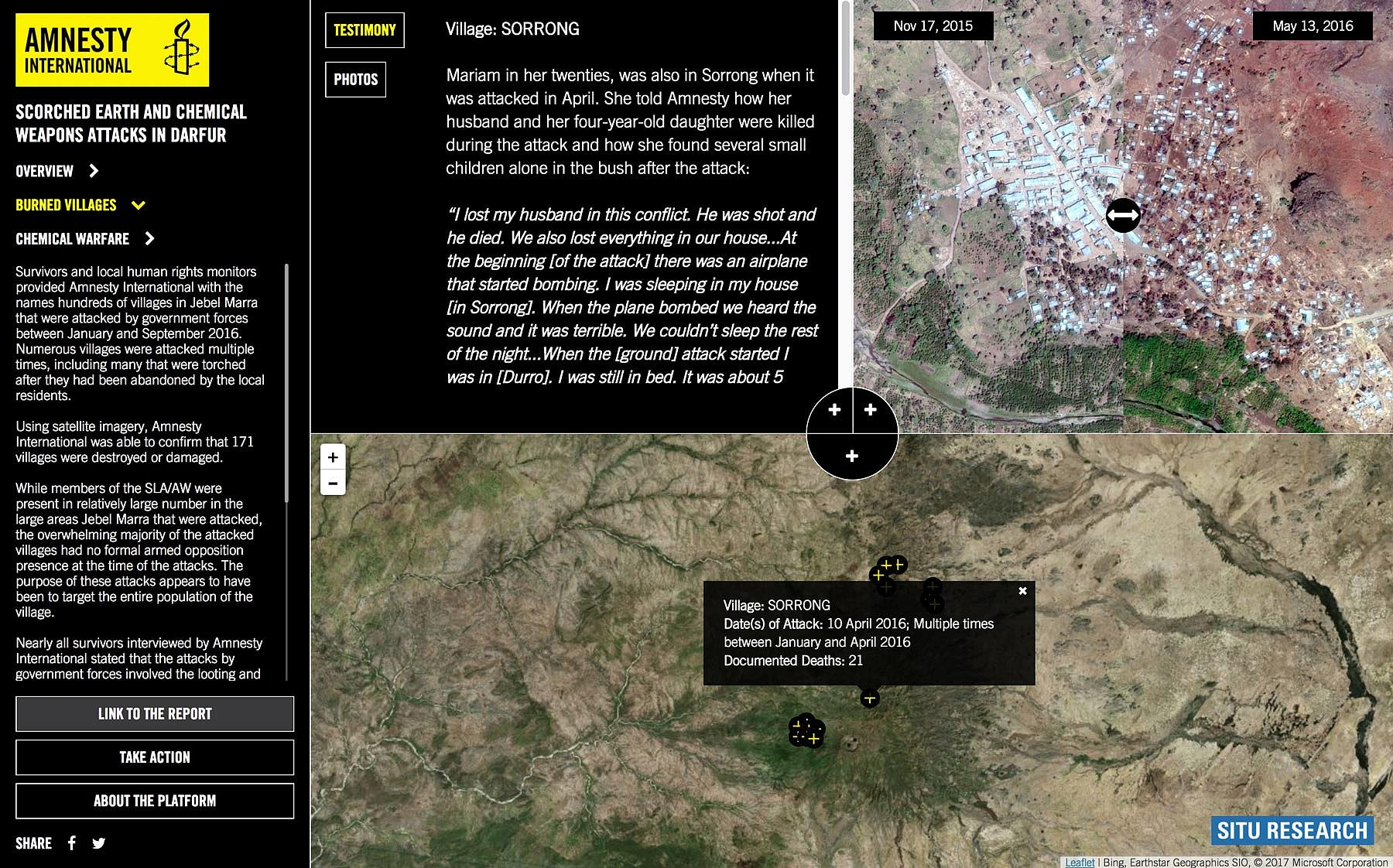
Remotely sensed data plays an especially central role in documentation efforts in this project. Jebel Marra spans around 5,000 square kilometers, and is home to approximately 1,500 dispersed villages and hamlets. Without ground access to the villages under attack, investigators relied on imagery captured before and after documented attack dates to see scorched earth tactics in the historical record. Without other visual sources documenting attack events at the village- or smaller, personal-scales, Amnesty and SITU created the only evidentiary narrative of these attacks with the satellite imagery at hand. The platform maps 171 attacked and damaged villages confirmed by Amnesty investigators through satellite image analysis. The attack sites with more documentation include alleged chemical weapons attacks, the photographic material for which is graphic and needed to be presented with sensitivity to audience safety and safety of those on the ground in Sudan.
Information on these attacks and the situation on the ground for civilians in the Jebel Marra is difficult to obtain and challenging to vet. The investigation was conducted from afar and is the result of 231 phone and internet interviews, and analyses of available satellite imagery. Presented with photos taken on the ground in Jebel Marra, this evidence is being shared to call for further investigation and action to protect civilian populations there.

The Overview page of the platform introduces users to the interface, a map of the region of Jebel Marra on which the 171 attacked and damaged villages that are confirmed via satellite analysis are mapped. Underlying data about the attacks includes the reported date of attack where available. Available documentation varies for each of the 171 sites, with only 16 containing testimony text and before and after satellite imagery, even fewer still have photo documentation of attacks.

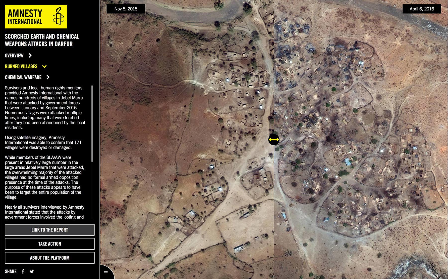
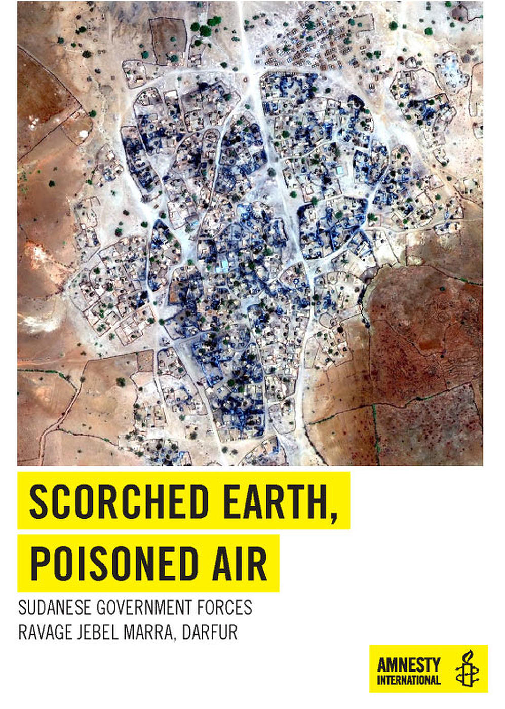
The Burned Village page presents testimony text, before and after satellite imagery and photos where available for 16 scorched earth attack sites. The data, accessible via “click on village location” in the map on this page, is the most recent and available information on the events. The villages featured on this page were selected for the completeness of the visual and textual evidence documenting the attacks that took place at each respective location.
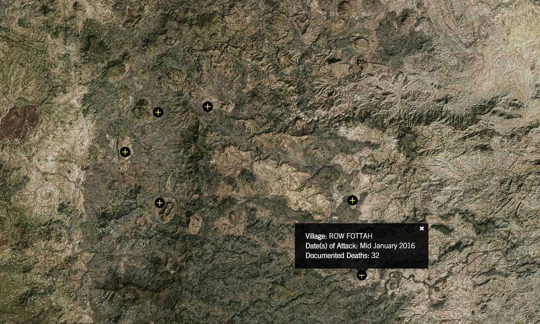
Mapping available photos to village locations, the Chemical Weapons page of the platform documents the effects of three alleged chemical weapons attacks on civilians in the Jebel Marra, predominantly children. Amnesty International documented alleged chemical weapons attacks in and around at least 32 villages in the region for their long-form report.
This collaboration aims to engage international leaders, human rights organizations and the broader public with the realities of Sudan's continued civil war, prompting international action and spurring greater accountability.
This project is part of SITU’s Spatial Practice as Evidence and Advocacy (SPEA) project, which seeks to utilize spatial analysis and visualization in the service of human rights fact-finding and reporting. The work of SPEA is funded by the John D. and Catherine T. MacArthur Foundation, Oak Foundation and the Open Society Foundations.